Environmental and climatic research project Baar – Building a geo-ecological information system (GOEKISBA) for the geo-systematical analysis of natural resource potentials
Within the framework of this project focused on the Baar region since 2001, characteristic parameters of natural space have been registered into a geo-ecological information system as a basis for analysis and quantification of natural resource potentials. Distinctive features of the regional climate are particularly important. The decisive factors are thermal and hygric continentality, which both influence the landscape-ecological process structure in many ways. For that reason, a dense meteorological measurement network was implemented already in 1994 to derive high-resolution climatic maps. GOEKISBA also includes satellite image based land-use classifications, digital geodata describing topography, geology, soils and bogs as well as biotope and geotope types for the Baar region.
Linked to current surveys of the natural potential vegetation of Baden-Wurttemberg at a scale of 1:200,000 in 2005 a landscape-ecological regionalization was derived of GOEKISBA data based on a decision-tree process. Finding the best fitting parameter set to describe the spatial patterns of natural potential vegetation was the main aim of this work. The regionalization derived is the foundation for further landscape ecological studies, especially concerning questions of environmental monitoring, sustainable environmental protection and land-use planning.
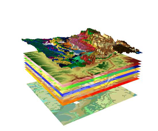
GIS-based natural resources analysis - schematic illustration
(data base: State Agency for Spatial Information and Rural Development Baden-Wurttemberg)
Project start: 2001